Dabeeo, a company specializing in geospatial artificial intelligence technology, announced Thursday that it will officially launch its next-generation smart monitoring program for forestry and plantation management in July.
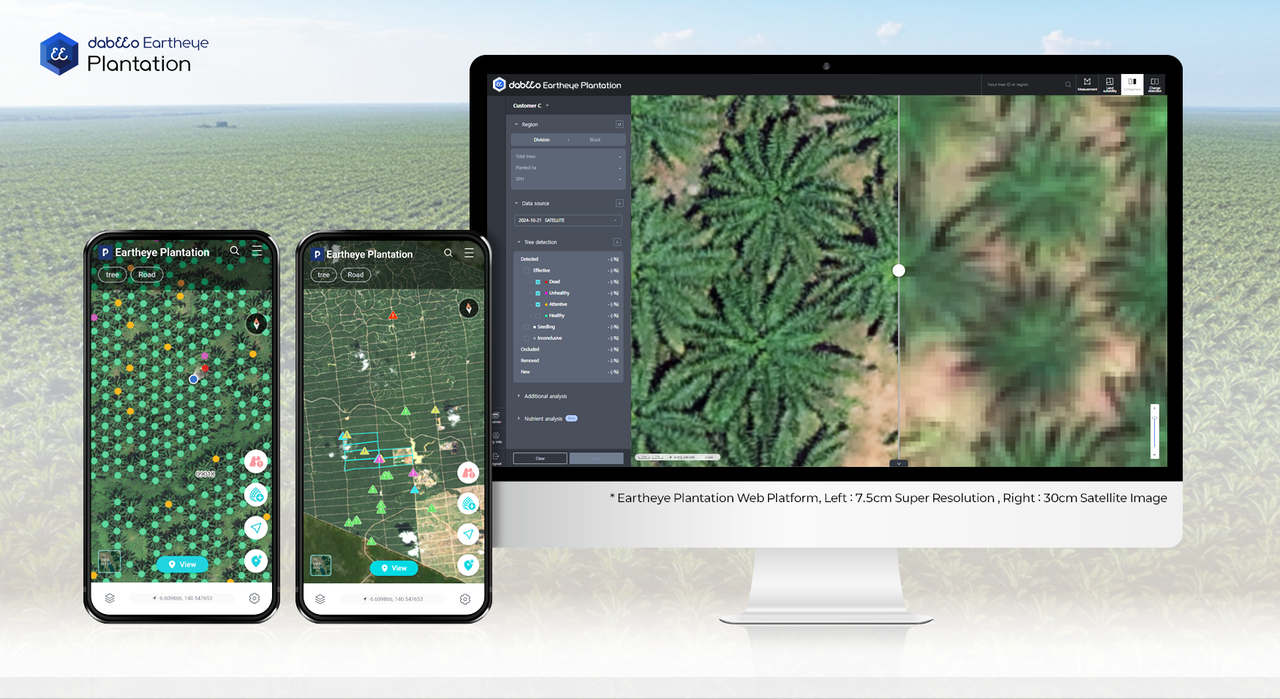
The platform -- Dabeeo Eartheye Plantation -- builds on the company’s achievement of commercializing 30-centimeter-resolution satellite imagery for agricultural use, the first of its kind globally.
The platform's dual structure includes a web interface and a mobile app.
The web version features enhanced AI analysis tools, including super-resolution technology that enhances satellite imagery to a resolution of approximately 7.5 centimeters, comparable to drone footage.
New features include high-density area detection, drone footage uploads with AI-based object recognition and 3D modeling for digital twin simulations.
These allow for solar exposure analyses, flood risk predictions and land suitability assessments at a granular level.
Lightweight rendering optimizes performance even in low-bandwidth environments, such as rural Indonesia.
The mobile app complements the system with offline access and a global positioning system-based navigation feature to identify problem areas in advance.
Field workers can use standard smartphone cameras to classify palm fruit ripeness via AI, improving productivity and enabling performance-based evaluations.
Reports generated offline are automatically synced when the internet is available.
“Eartheye Plantation is more than just a monitoring tool -- it’s a comprehensive solution for driving operational efficiency and real digital transformation in plantation management,” said Dabeeo Vice President Victor Choi.
Dabeeo aims to expand the platform as a smart forestry management standard across Southeast Asia.
spark@heraldcorp.com