Pedestrians are seen walking near Daechi Station in Gangnam District amid a torrential downpour on Monday night. (Yonhap)
Record-breaking torrential downpours swamped many parts of Seoul and Gyeonggi Province on Monday.
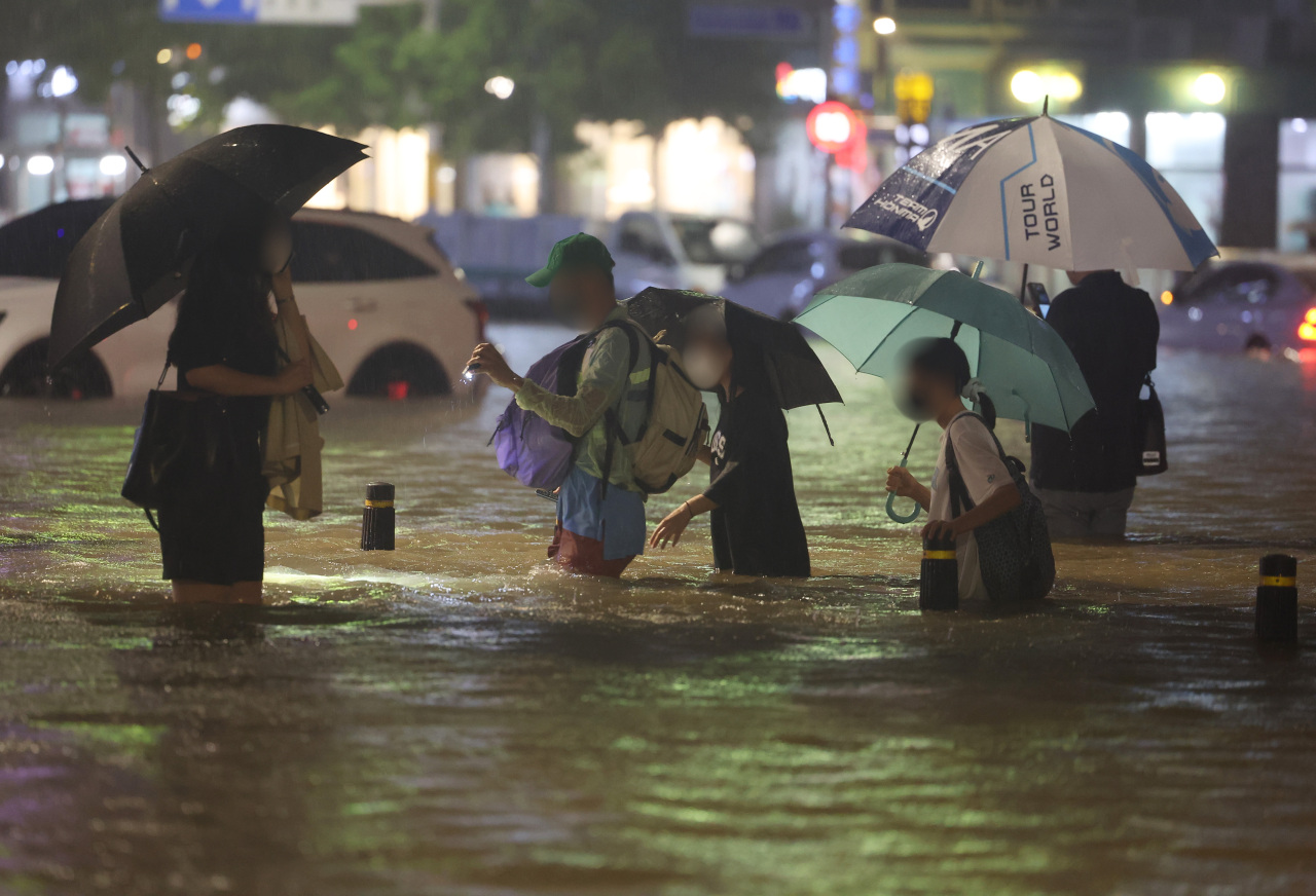
But the hardest hit area in the region was Gangnam, the capital’s affluent residential district, and its surrounding neighborhoods. Images and videos of people wading through knee-high water near Gangnam Station and cars submerged underwater and left stranded in the middle of the road in nearby Daechi-dong went viral.
This is not the first time that neighborhoods in southern Seoul have suffered from flash floods due to heavy rain. In September 2010 and July 2011, the area was similarly struck by floods following torrential downpours.
So why is the neighborhood, which gained international fame after the success of the hit song “Gangnam Style,” more likely to experience flash flooding compared to other parts of the city?
Low-lying metropolis Long before Seoul became the modern metropolis it is today, Gangnam was a muddy flatland, home to a few sparsely scattered villages. Lying low near the river, the area was prone to floods.
Fast forward to 2022, Gangnam is all asphalt and concrete, with the same geological conditions: Over 75 percent of the land in Gangnam District has an altitude lower than 40 meters and a land slope angle of 5 percent.
While a great deal of the neighborhood is flat land, the area surrounding Gangnam Station is low-lying compared to nearby districts like Seocho-dong and Yeoksam-dong, making it easier for rain water to accumulate. Some parts are estimated to be 10 meters lower in altitude than their surrounding areas. Due to this, the area has been compared to a hangari – a traditional Korean earthenware jar.
Record rainfall in southern SeoulAs for what happened Monday night, the amount of precipitation also need to be considered.
The Korea Meteorological Administration said Monday’s downpour hit the southern parts of the capital harder than other areas in the city.
“Between yesterday (Monday) and today (Tuesday), there was 425.5 millimeters of rain in Dongjak Ditstrict, 400.5 millimeters in Seocho District and 380 millimeters in Gangnam District,” one official told the Korea Herald on Tuesday morning. The three districts form the so-called Gangnam trio.
“A belt of clouds moved towards the southern part of Seoul, bringing more rain to the area.”
As cold air mass from the north traveled to Korea where it is warm at the moment, precipitation took place in the middle, which happened to be southern Seoul, the official explained.
Anti-flood efforts not enough
“Since the floods in 2012, we have continued to ramp up measures and improve infrastructure such as building underground flood tunnels. We can withstand up to 85 millimeters of rain per hour now. In the past, we were only prepared for 45 millimeters,” said one senior official at the Seoul Metropolitan Government.
Construction for a new flood tunnel in nearby Banpo was completed in June, but its current infrastructure was not prepared for Monday night’s downpour which exceeded 110 millimeters per hour, the official added.
In 2015, the city government announced plans to mitigate the drainage issue in the Gangnam and surrounding areas worth some 1.4 trillion won ($1.07 billion). The work was originally due to be completed by 2016, but due to budgetary and other issues, it has faced delays.
The city aims for the project to be completed by 2024.
But even with said project, experts point out that the drainage system will not be able to endure extreme rains as seen this week. The system was designed to withstand a severe rain event that occurring once every 30 years. Monday’s rainfall was the heaviest recorded in 115 years.